Would you like to discover the most beautiful place in Madeira, the typical houses, the amazing viewpoints and the caves created by volcanic lava? Great! In this article you’ll discover Pico Ruivo, the highest peak in the island (1861 metres), the town of Santana, amazing viewpoints and the beautiful São Vicente caves.
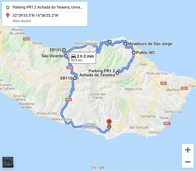
The places that you’ll find throughout this article were the ones I visited during my fifth day in Madeira. You should follow this guide in this order so that you can visit all these beautiful places without losing too much time travelling between them.
Throughout this article, I’ll also give you tips about each of the places I visited so you can better prepare your trip to the beautiful Madeira island.
Disclosure: This post may contain affiliate links, meaning i get a commission if you decide to make a purchase through my links, at no cost to you. Please read my disclosure for more info.
Achada do Teixeira Path – Pico Ruivo
Sommaire
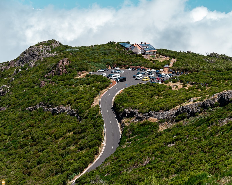
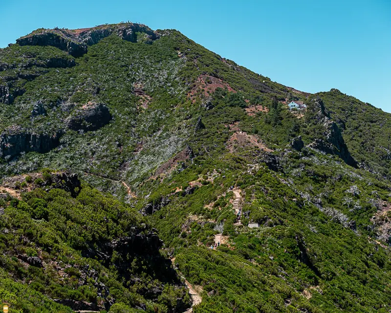
Achada do Teixeira to Pico Ruivo walking route is about 2.8 km (5.6 km total) and is one of the most beautiful walking routes on the island and anyone can do it.
Even though it is accessible to everyone, this walking route is not the easiest to do in Madeira – it’s 300 metres upwards from Achada do Teixeira to Pico Ruivo.
On average, it’s a one and a half hour walk, but if you’re not used to mountain trails then go slowly and stop as many times as you need. Don’t forget to take photos whenever you stop.
When I left Funchal to do this walking route, the sky was blue and the sun was warm, but the more I got close to the north of the island the more cloudy it was.
When I arrived to Santana (10 km from Achada do Teixeira), aside from the cloudy sky, it was pouring rain. Can you imagine leaving Madeira without having the chance to see one of the most beautiful places on the island (based on my research when I was preparing my trip to the island)?
After some minutes talking to myself I finally made up my mind and went to the starting point, hoping that this bad weather was only at sea level.
Santana is located at sea level (or nearly) and Achada do Teixeira is at 1500 metres high. I hoped I was right about taking the chance.
Unfortunately, when I arrived to Achada do Teixeira, clouds and rain were still there. Well, it was more like haze making it very hard to see beyond 10 metres.
This time, I wasn’t expecting to get to Pico Ruivo at all. Aside from the awful weather that wouldn’t let me see a thing, it was also very dangerous to go up hill in those conditions.
However, I looked at the parking lot and I saw three cars which meant that some people had the courage to face that weather and went on to Pico Ruivo.
I thought: “well, I got this far so I’m going to wait a little bit more and see what happens.”
Unfortunately, the weather remained the same, but people kept coming and amazingly and without hesitating went on a stroll – destination: Pico Ruivo.
When I saw people taking a chance, I decided to go along – if they were doing this was because they knew that the weather was better up there. As a precaution, I waited for more people to come so I didn’t have to go alone, because it was too risky due to the bad weather.
Finally, after a few hundred metres, the sun showed up behind the clouds and we even got to see a beautiful rainbow.
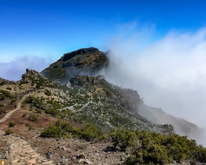
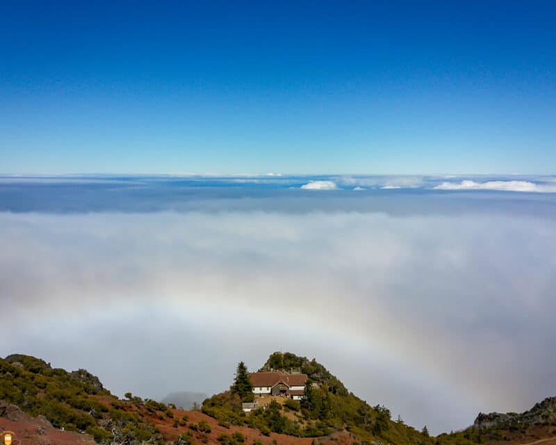
As I entered that safe haven, I got to see a clear blue sky with the clouds at my feet. I can tell you that it’s the most amazing experience!
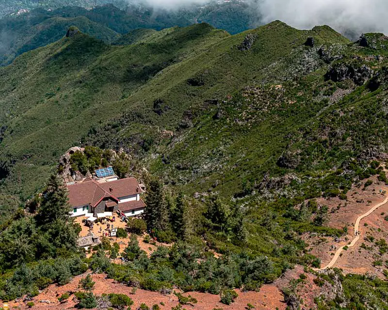
The last metres, from the shelter to Pico Ruivo were the toughest because it was a steep climb.
When I got to Pico Ruivo, a beautiful landscape was the reward – it was so beautiful that I stood there for two hours just gazing at the horizon and the sun.
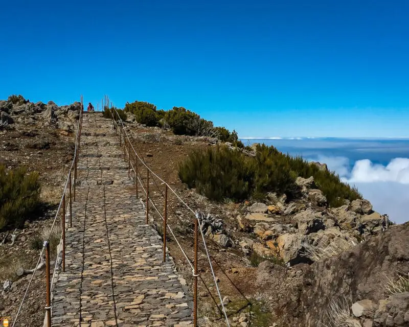
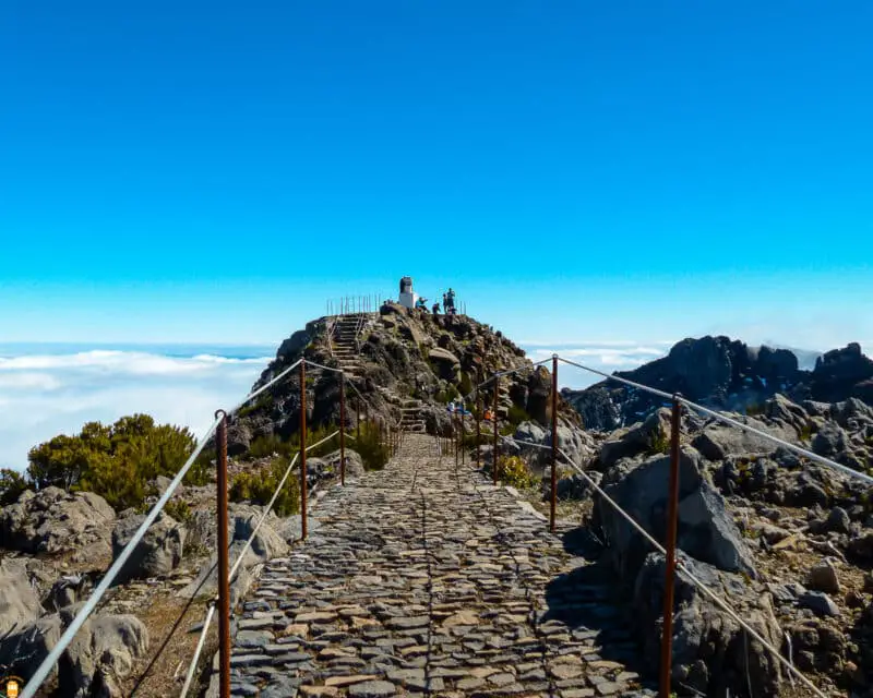
Tip: take sunscreen with you and take off your sunglasses otherwise you’ll just get half tanned.
Information: do you want to climb to Pico Ruivo with an experienced guide? If that’s the case, I suggest you go on this walk between Achada do Teixeira and Pico Ruivo . With the company of a mountain guide, you will be sure to make the journey safely and with access to information that will make this experience unforgettable.
Aren’t you convinced with this photos of Pico Ruivo? Then, watch this video to get a taste of what you’ll find there.
How to be sure about the weather in Pico Ruivo?
Before adventuring into this wild beauty, my suggestion is that you take a look at this webcam. Here, you can see real time weather in Pico do Arieiro, the second tallest peak in Madeira.
Pico Ruivo is located near Pico do Arieiro and is about the same height so you’ll have an idea about the weather you’re going to get.
- GPS: 32°45’54.1″N 16°55’16.1″W
Santana
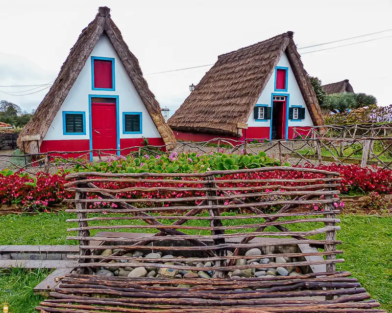
Even though it was still raining, after that walking route, I stopped in Santana so I could see the traditional Madeira houses.
Don’t think that you’re going to see several of these houses – there are only a few near city hall and in Madeira Theme Park.
Aside from the traditional houses, you’ll get to see in Madeira Theme Park local traditions, handicrafts and you can also taste the island’s gastronomy in the restaurant “O Til”.
- GPS traditional houses: 32°48’18.6″N 16°52’57.0″W
- GPS Madeira Theme Park: 32°48’14.3″N 16°53’04.8″W
Information: take the opportunity to do some guided tours around the island! The first suggestion I have for you is one that will take you on a discovery of the east side of Madeira . In this 8-hour activity, you will have the possibility to visit fantastic places and admire stunning landscapes. One of the highlights of this tour is literally at the top, at Pico do Areeiro; the other will be a visit to the beautiful location of Santana, where you can admire the typical houses of Madeira.
If you prefer to explore north of Madeira , know that you have a perfect activity here. With an approximate duration of 7h30, you will have the opportunity to visit some of the most beautiful locations on the island, such as São Vicente and Santana.
São Jorge Viewpoint
Located 7 km from Santana, this viewpoint will offer you the opportunity to admire this beautiful landscape.
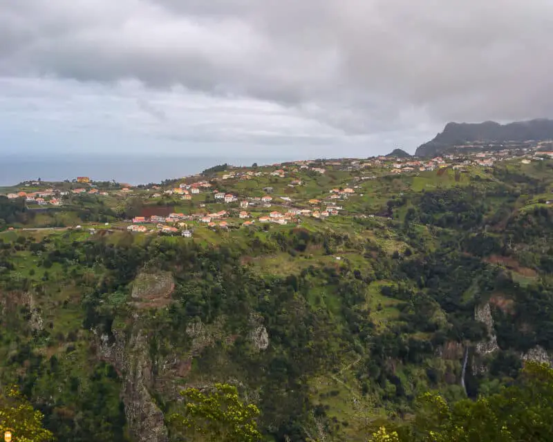
- GPS: 32°49’21.3″N 16°54’09.2″W
Cabanas Viewpoint
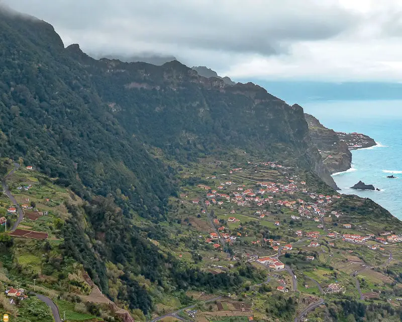
Towards São Vicente, stop at this viewpoint to admire this beautiful view over the sea and the north of the island.
- GPS: 32°49’34.3″N 16°56’18.5″W
São Vicente Caves
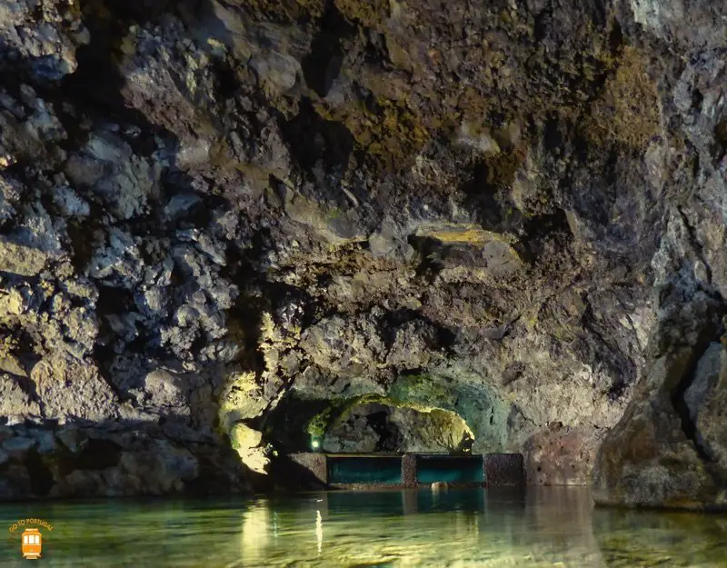
São Vicente caves are the result of a volcanic eruption in Paul da Serra, more than 890 000 years ago.
These caves were formed by lava tubes created by low temperatures, enabling the solidification of the outer side while lava kept flowing in the interior and, this way, forming several tubes.
During your visit you’ll have the opportunity to walk through a 700 metre-path where you can admire these lava tubes.
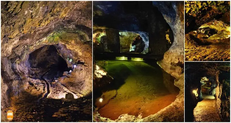
After your visit to the caves (30 minutes), you can visit the volcanism centre where you can see a recreation of volcanic eruptions, how the beautiful Madeira island was born and much more.
São Vicente Caves are not the most amazing in Portugal, but surely are worth the visit. I loved walking through the tubes imagining lava flowing by.
- Site: www.grutasecentrodovulcanismosaovicente.com
- GPS: 32°47’54.9″N 17°02’29.3″W
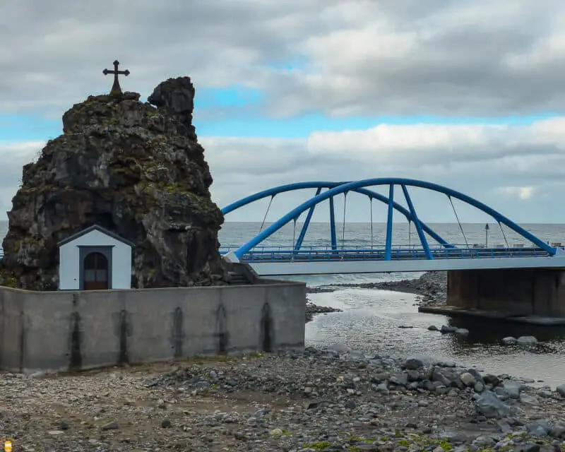
Before you leave São Vicente, visit the town centre to discover the main church and Capelinha do Calhau that you can see on a rock between the river and the sea.
On your way back, and if you have time, don’t forget to stop at Encumeada Viewpoint (GPS: 32°45’16.3″N 17°01’12.2″W) and Pico dos Barcelos Viewpoint (GPS: 32°39’33.5″N 16°56’25.2″W).
Are you going to visit Madeira? Then don’t hesitate to book your hotel room, your car or the best activities by clicking the links below. This way you are helping me in the development of my blog and I’ll be able to offer you free tips and travel guides so that you can better prepare your visit to Portugal. Thank you!
What will also interest you:
- Top 40 of the places to visit in the Madeira and Porto Santo islands
- Top of the most wonderful Madeira walks and activities
- Visit to Câmara de Lobos, Cabo Girão and Fajã dos Padres
- Visit to Pico do Arieiro, Curral das Freiras and Ponta de São Lourenço
- Visit to Porto Moniz, Levada das 25 Fontes and Paul da Serra
- What to do in funchal, Madeira – The seven places you must visit

